Midweek Storm System Update
Written on January 7, 2013 at 8:59 pm, by Adam Cuker

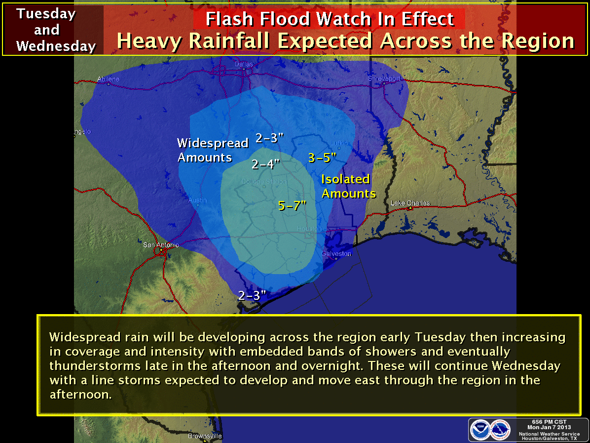
A Flash Flood Watch has been issued starting Tuesday afternoon through Wednesday evening across southeast Texas. Isolated amounts of 5-7 inches are possible across southeast Texas with lower amounts to the northwest.

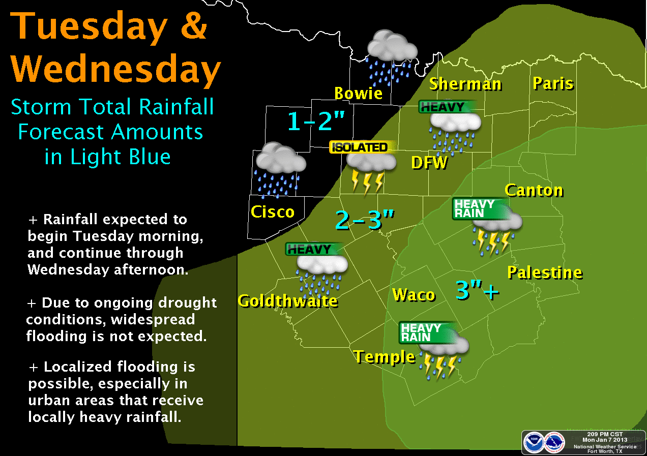
Heavy rainfall is expected over Central Texas starting Tuesday through Wednesday with 2-3 inches possible west of I-35 with higher amounts to the east and southeast.

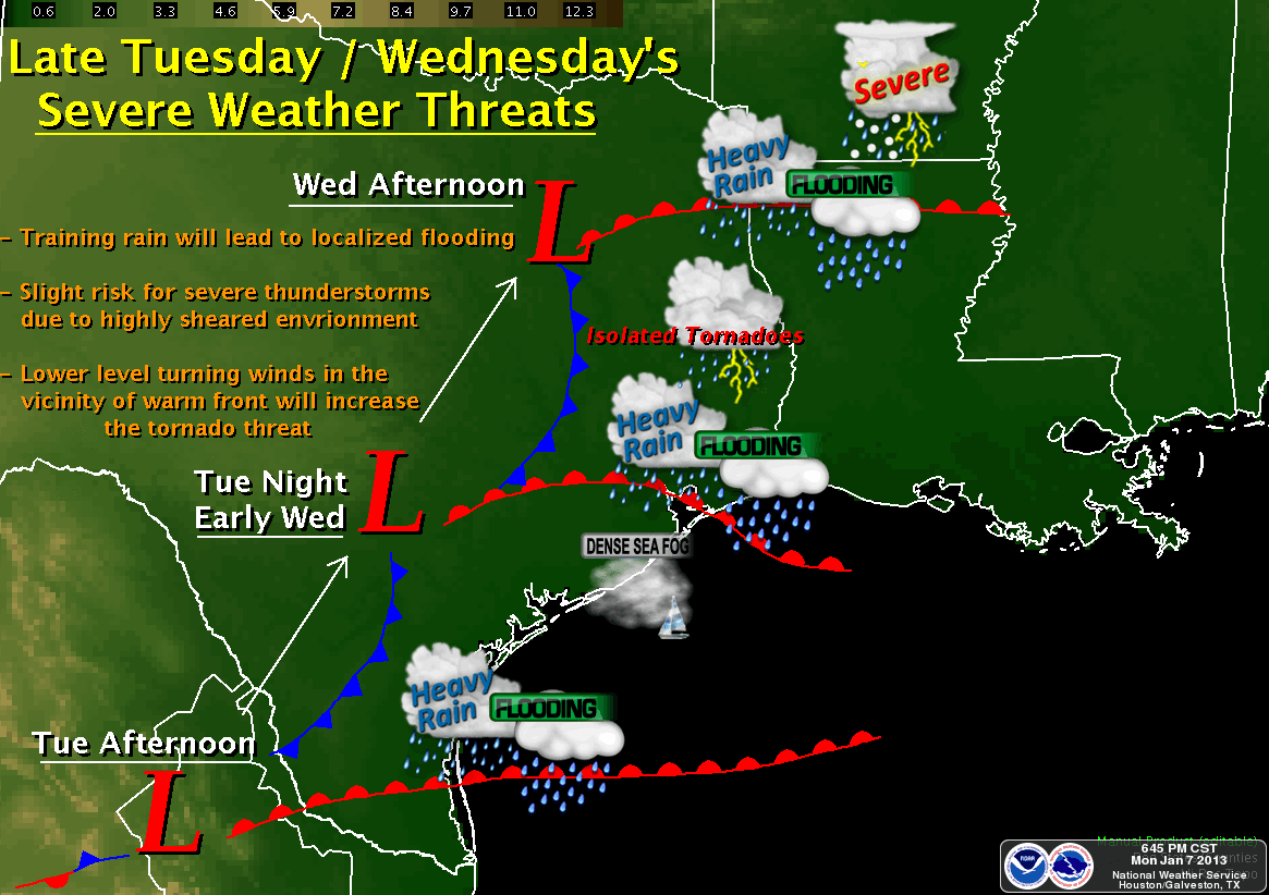
Starting late Tuesday into Wednesday there will be a risk of severe weather. As a warm front lifts north across the southern and eastern half of Texas (mainly along & east of I-35), this area will have the best chance to see some severe weather. The threat includes damaging winds mainly along the cold front and isolated tornadoes close to the warm front.

No comments yet. You should be kind and add one!
The comments are closed.