Severe Weather/New Website
Written on April 12, 2012 at 12:20 pm, by Adam Cuker
With the powerful weather system that will be impacting the central and southern plains tomorrow throughout the weekend, we have decided to launch our updated Vortex Chasers website (VortexChasers.net). The updated website has a new and improved layout to help our visitors more easily navigate throughout the website, and help them better receive information about upcoming severe weather events. With the NEW “LIVE-WX” page, our interactive map makes it easy to watch our live video stream all while being able to view the latest radar and current conditions. This website and our continued success would not be possible with out our sponsor Toyota of Killeen and our partnership with KTWX-TV (CH10 – Central Texas).
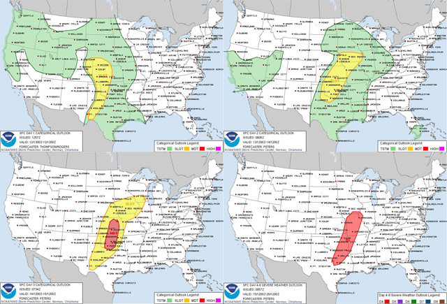
The graphic above shows where the potential area for severe weather will be over the next few days. Please click on the image above to get the most recent updates from the Storm Prediction Center. Today through Sunday there will be a chance for severe storms in the central and southern plains with Saturday being the highest chance. All modes of severe weather will be possible with very large hail, damaging winds and tornadoes. Stay tuned as we will be chasing this event and posting severe weather updates as they occur.


No comments yet. You should be kind and add one!
The comments are closed.