Tropical Storm Karen
Written on October 3, 2013 at 9:07 am, by Adam Cuker
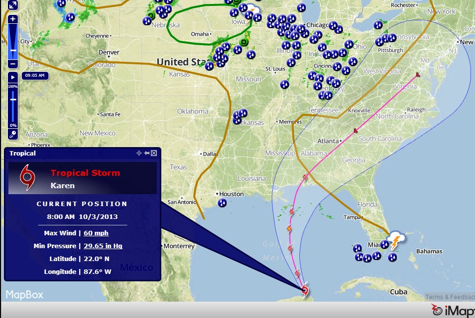
Tropical Storm Karen forms over the southeastern Gulf Of Mexico. The tropical storm is approximately 500 miles south of the mouth of the Mississippi River with maximum sustained winds at 60 MPH. Present movement is to the north northwest at 13 MPH. Some strengthening is forecast during the next 48 hours and Karen is expected to be at or near hurricane strength on Friday. A hurricane watch is in effect from Grand Isle Louisiana eastward to Indian Pass Florida. A tropical storm watch is in effect from west of Grand Isle to Morgan City Louisiana. To keep up with the latest forecast track visit www.VortexChasers.net/LIVE for the interactive map or the National Hurricane Center www.nhc.noaa.gov
No comments yet. You should be kind and add one!
The comments are closed.