Tuesday Severe Weather Update
Written on January 28, 2013 at 10:07 pm, by Adam Cuker
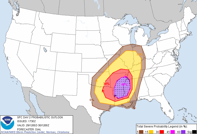
The Storm Prediction Center has placed a slight risk of severe weather from Central Texas through the mid Mississippi Valley into western parts of the Tennessee and Ohio Valleys on Tuesday. There is a moderate risk of severe weather from northern Louisiana, central/eastern Arkansas, extreme southwestern Tennessee and northwestern to west central Mississippi. Storms are expected to develop within pre-frontal confluence band across central/eastern Oklahoma into north central Texas early Tuesday and shift eastward and northwestward during the day. Other storms may develop farther south through eastern Texas during the afternoon along the pacific front and shift eastward through the lower Mississippi Valley. The main severe weather risk will be from damaging winds although a few tornadoes and large hail can’t be ruled out. The tornado threat may increase overnight especially in the moderate risk area.

(Closer view of the slight risk over Central Texas)
No comments yet. You should be kind and add one!
The comments are closed.